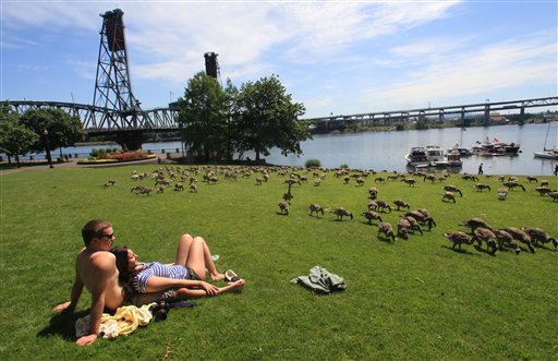

WASHINGTON – Sweaty, sticky and dangerous. It is easy to feel the effects of the temperature spike around Washington. And staying cool is not only smart but doctors say it’s important for peoples’ health.
For the second day in a row, the region was under a heat advisory that the National Weather service canceled at 5:15 p.m. The Code Orange air quality Thursday increased the risk of heat-related illnesses.
While temperatures were in the upper 90s, the National Weather Service says it felt more like 100 to 105 degrees.
The record high temperature for the day in Washington is 98 degrees, set in 1988. The record in Baltimore is 100, set in 1923. At just before 8 a.m., both areas reached 83.
ABC7 Meterologist Ron Riley says high pressure over the Carolinas is pumping up heat and humidity from the South.
Across the Northeast, temperatures will make life miserable Thursday.
Thursday’s air quality is a Code Orange. Sensitive groups, such as children, older people and those with respiratory and heart conditions should limit outdoor activities.
The forecast calls for Friday to remain hot, with temperatures in the lower 90s. There is a 60 percent chance of showers and thunderstorms during the afternoon and evening hours as a cold front approaches.
The area will see some relief from the heat and humidity on Saturday and Sunday as slightly cooler air arrives.
Be prepared for heat
Doctors urge you to drink lots of water, at least two to three liters a day to stay hydrated, and to know the signs of heat-related illnesses.
Here are some other reminders to help stay cool:
- Wear lightweight, light-colored, loose-fitting clothing;
- Wear a hat to shield yourself from the sun;
- Use sunscreen;
- Drink lots of water. Remember that caffeinated beverages can increase the rate of water loss in your body, increasing your risk of heat exhaustion or stroke.
- Hang out in the air conditioning or shade;
- Don’t leave children or pets in the car;
- Do not open fire hydrants to cool off. Doing so can hamper firefighting and cause flooding and injuries.
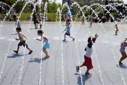
WHERE TO COOL OFF
In the District, here are places where you can cool off:
Pools
Select District pools will remain open until 8:30 p.m. through Friday. They are:
- Banneker Recreation Center Pool, Ward 1
- Jelleff Recreation Center Pool, Ward 2
- Harry Thomas Sr. Pool, Ward 5
- Rosedale Pool, Ward 6
- Benning Park Pool, Ward 7
- Anacostia Pool, Ward 8
Pool hours are extended at the Laurel Municipal Pool and the Greenview Drive Pool, which will open at 11 a.m. through Thursday.
Cooling Centers:
- The Laurel Armory Anderson-Murphy Community Center will be open from 9 a.m. to 9 p.m.
Note: For a complete list of cooling centers and hours, click here.
Spray Parks:
- Girard Street Park, 15th and Girard Street, NW
- Fort Davis Recreation Center, 1400 41st Street, SE
- Palisades Recreation Center, 5200 Sherrier Place, NW
- Petworth Recreation Center, 801 Taylor Street, NW
- Lafayette Recreation Center, 5900 33rd Street, NW
- Riggs La Salle Recreation Center, 501 Riggs Road, NE
- Guy Mason Recreation Center, 3600 Calvert Street, NW
- Arboretum Recreation Center, 2412 Rand Place, NE
- Benning Stoddert Recreation Center, 100 Stoddert Place, SE
- Joseph Cole Recreation Center, 1299 Neal Street, NE
Related Stories and Helpful Information:
The Associated Press contributed to this report. Follow WTOP on Twitter.
(Copyright 2012 by WTOP and The Associated Press. All Rights Reserved.)