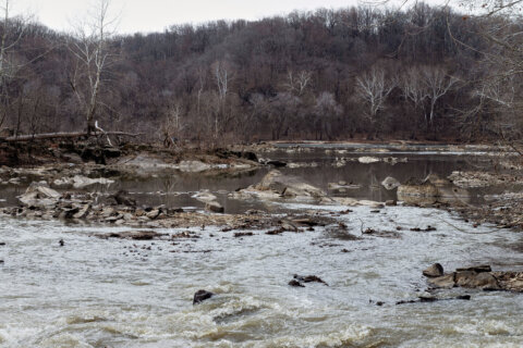
On-and-off showers soaked the D.C. region Saturday before turning heavy in the evening.
The National Weather Service predicted cooler temperatures, rain showers and plenty of clouds across the D.C. area as a frontal boundary remains stalled to the west. Some storms slowed traffic on Route 50 in Prince George’s County, Maryland, as drivers navigated floods along the highway.
WTOP Traffic reporter Steve Dresner said off-and-on high-standing water was also causing slow traffic along the northbound lanes of the Baltimore-Washington Parkway between Route 50 and The Beltway.
He said drivers who travel too closely to each other can expect road spray to interfere with visibility.
7News First Alert Meteorologist Jordan Evans said Saturday will be “damp and dreary,” with rain chances “staying at 100% throughout the day.”
He expects a quarter-inch of rainfall during the day, with another quarter-inch to a half-inch before Sunday morning.
While the National Weather Service forecasts low chances of a thunderstorm Saturday night, rain is expected to become more intense, with “unsettled weather” continuing Sunday.
The weather service issued a Coastal Flood Advisory for D.C. from 4 p.m. Saturday until 9 a.m. Sunday, with shoreline inundation expected “along portions of the seawall adjacent to Ohio Drive and the Hains Point Loop Road and near the Tidal Basin.”
Tides are expected to be “one to one and a half feet above normal,” according the National Weather Service, while noting next high tide at the Washington Channel is between 5:44 p.m. Saturday and 6:09 a.m. Sunday.
Evans said to expect “a few rumbles of thunder” on Sunday.
- Listen to WTOP online and on the radio at 103.5 FM or 107.7 FM.
- Current traffic conditions
- Weather forecast
- Sign up for WTOP alerts
A warm front should lower the risk for severe weather on Monday and clouds will stick around the D.C. region, according to the National Weather Service. But Evans said the chance for more showers and thunderstorms rise later in the day.
He said increased heat and humidity “may bring a few storms, some strong,” to the D.C. area on Tuesday. But added that the “risk for severe weather is low,” for now.
Thunderstorm chances are expected “to increase mid week,” according to the National Weather Service.
7News First Alert Forecast
SATURDAY EVENING:
Showers
Temperatures: 50s
Winds: East 5-10 mph
Showers becoming a widespread rain. Temperatures holding steady in the mid 50s.
SATURDAY NIGHT:
Rain continues
Lows: 50-59
Winds: East 10-15 mph
More rain expected during the overnight into tomorrow morning. Heavy rain and thunder is not expected.
SUNDAY:
Rain, Thunder Possible
Highs: 70-76
Winds: Southeast 5-10 mph
It will be another overcast day, but high temperatures should reach the upper 60s and lower to middle 70s. Rain is likely and it may become heavy at times along with a few rumbles of thunder.
MONDAY:
Overcast, Evening Storms
Highs: 77-83
Winds: Southwest 5-10 mph
Clouds stick around with the chance for more showers and thunderstorms later in the day. The risk for severe weather is very low.
TUESDAY:
Passing clouds, few evening storms
Highs: 80-86
Winds: Southwest 5-10 mph
The added heat and humidity may bring a few storms, some strong, to the area. The risk for severe weather is low, but changes are expected with new data over the coming days.
WEDNESDAY:
Partly cloudy, chance for storms
Highs: 80s
Winds: Southwest 5-15 mph
Likely the driest day of the week, but an isolated shower or storm still possible in the afternoon.
Current weather
Get breaking news and daily headlines delivered to your email inbox by signing up here.
© 2024 WTOP. All Rights Reserved. This website is not intended for users located within the European Economic Area.