Jamie Slater, special to WTOP.com
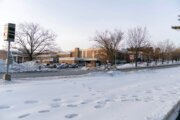
WASHINGTON — D.C. has seen its fair share of winter weather this week, but it’s not over yet.
Experts expect temperatures to stay in the freezing range for most of the weekend, but it will feel even colder.
A “wind chill advisory will kick in at 10 pm [Friday night]…got another clipper on the way,” says ABC7 meteorologists Mike Stinneford.
It could feel like 3 degrees below, so make sure to take extra care when leaving the house.
Saturday might bring snow, but don’t hold out for another snow day. Areas north, northeast and possibly east of D.C. are expected to get hit the worst with only up to an inch. No matter what, it should be breezy and cold all day, starting with feeling like subzero temperatures again in the morning.
There’s another chance of snow late Sunday night, but the morning at least will be sunny even if forecasted lows in the mid-20s still aren’t warm enough to warrant going outside unnecessarily.
Sunny skies on Monday morning should provide a good start to the week, but low temps are expected to drop to the single digits that night and won’t rise much all week.
Follow @WTOP on Twitter.